Stage 17 - The Ridgeway - Princes Risborough to Ivinghoe Beacon - August 6th 2025
- John Tippetts

- May 6
- 8 min read
Updated: 3 days ago
Official Stage Statistics
Route distance – 18.57 miles
Total ascent – 2371 feet
Total descent – 1979 feet
Highest point – 846 feet

Logistics
Drive to the Mount Car Park Princes Risborough HP27 9AN and park car - £3.70 all day - RingGo Location - 5251251
Walk to Ivinghoe Beacon
Get picked up and taken back to Princes Risborough to collect car
Tea at pub
Drive home
My Walk
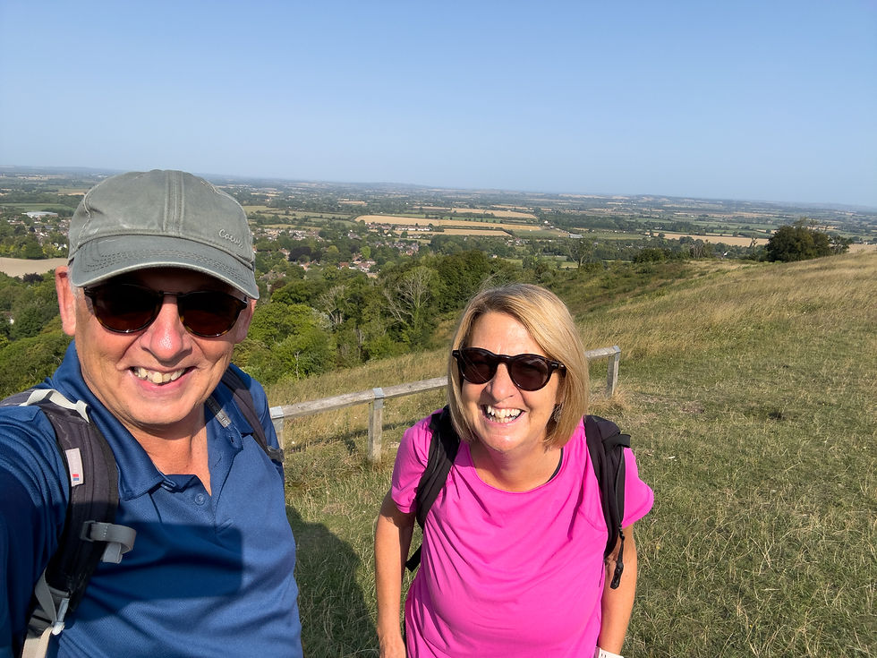
It was more than 8 weeks since I completed the Mongewell to Princes Risborough stage but finally the moon and stars aligned and my sister Nicky and I set off to complete the final stage of The Ridgeway. We’ve done this walk 3 times before by taking part in the annual Rennie Grove Hospice Chilterns 3 Peak Challenge, so we knew exactly what to expect – except this time we wouldn’t have lots of volunteers along the route cheering us on and providing us with water, cakes and sweets!
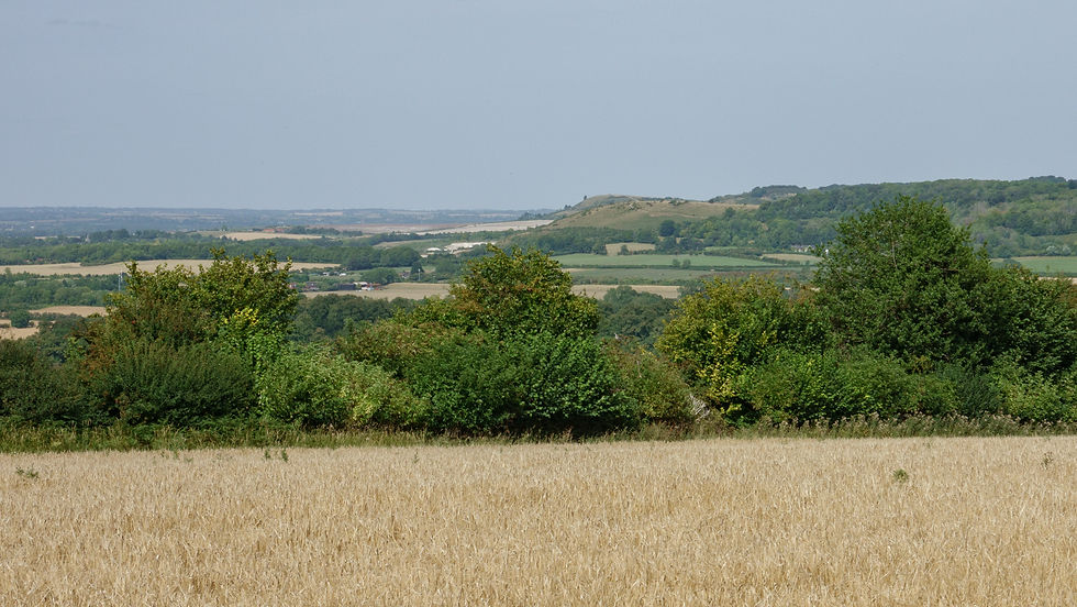
Today would be very much an up and down day, this stage providing the largest ascent and descent figures of the entire Great Chalk Way. The walk would begin in the town of Princes Risborough with a steep climb up to the top of Whiteleaf Hill. This would set the tone for the rest of the day with drops and climbs through woodland and downland. Coombe Hill would be the 2nd of the 3 peaks with the path then dropping down into Wendover. Another climb up through woodland would be followed by a long and steady drop down into Tring. Finally, we’d do a steady climb up towards Ivinghoe Beacon, the 3rd peak, culminating with a relatively steep climb to the top. I regard this stage as one of the very best of the whole Great Chalk Way. It offers some spectacular views of the Chilterns.
My day began with a 60 mile drive to Nicky’s house to pick her up. We drove to Princes Risborough and parked the car. Within a few minutes we were out of the centre of town and climbing up through Brush Hill Nature Reserve towards the top of Whiteleaf Hill. The views from the top were truly fabulous on what was a glorious day.


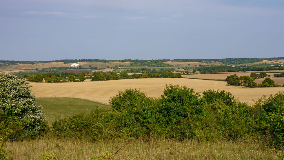
Whiteleaf Cross is a cross-shaped chalk hill carving with a triangular base, cut into the slope of the hill that faces the town. Whilst you can walk down the steep slope to see the cross, like all such chalk carvings, it is best viewed from the air. I hadn’t brought my drone with me on this walk to save bulk and weight in my backpack. I did however do a revisit a few weeks later with my drone and full-size camera to get more pictures and I’ve added a few of these to this post.


From Whiteleaf Hill we descended quite steeply through woodland, emerging in the village of Cadsden at The Plough. This pub is quite famous, being the ‘local’ for Chequers, the Prime Minister’s country residence, which we would pass further on. David Cameron (remember him?) famously took the Chinese President Xi Jinping there for a pint of IPA during his state visit in 2015, at a time when we were friends with China! There are numerous photos inside the pub of the occasion. A year later, a Chinese company bought the pub! The pub became famous in Chinese circles following the visit of the President and it has become quite a tourist attraction for Chinese visitors ever since.
The Plough is the same pub where in 2012, the Cameron’s left their daughter Nancy – albeit only for about 15 minutes. Mr Cameron had left the pub in one car with his bodyguards, whilst Mrs Cameron left in another car with their other children. Mrs Cameron assumed Nancy was with her dad and it was only when they got back to Chequers that they realised Nancy was missing. She dashed back to the pub and found Nancy helping the staff, so all was well!


From Cadsden, naturally, the path climbed through a mixture of woodland and downland. It levelled off as we approached the fencing surrounding the Chequers estate. There were plenty of stern warning signs advising us that it would be best not to climb over the fences.


After skirting around Chequers the path continued its climb through woodland before we emerged onto Coombe Hill and more spectacular views. The summit of Coombe Hill is 852 feet high. The National Trust, who maintain the site, claim it’s the highest point of the Chilterns. However, Haddington Hill, less than 3 miles away is 876 feet high and has a series of large stones bearing the inscription 'The Chiltern Summit'. The stones are surrounded by trees, so maybe Coombe Hill should be the highest viewpoint in the Chilterns??


The viewpoint on Coombe Hill is marked with a monument dedicated to the men of Buckinghamshire who gave their lives in the Boer War. The monument is an iconic Buckinghamshire landmark and is Grade II listed. There are always people there taking selfies against the backdrop of the monument. We always stop here for a snack, admiring the views.


From the top of the hill, the carnage inflicted by HS2 on Wendover was plain to see. Rather than tunnelling deeper down, which local people were less unhappy to accept, it was decided by HS2 to construct a 1 mile ‘green’ tunnel for Wendover. A green tunnel comprises shallow concrete tunnels that are built on the surface before being buried, with trees, plants and shrubs planted on top to blend into the landscape. HS2 claim that building green tunnels helps reduce the impact on people and nature. This cut and cover approach is also claimed to be considerably cheaper than bored tunnels using tunnel boring machines. Despite huge local opposition, work finally began in earnest in 2021.

As we descended into the town and crossed the temporary metal bridge over the excavations, the scale of works could be seen at close quarters. It looks so awful now and goodness knows how many years it will be before people can finally say “You’d never know that there are HS2 railway tunnels below us!”.


If you are ever in Wendover and in need of coffee and cake I can thoroughly recommend calling in at Rumsey’s Chocolaterie at number 26 High Street. They sell some divine cakes and many chocolate products that are made on the premises. They have plenty of tables and also do take-aways. As it was the height of summer, we decided to carry on without stopping today and anyway, I’d brought cake from home for us to eat at some point.


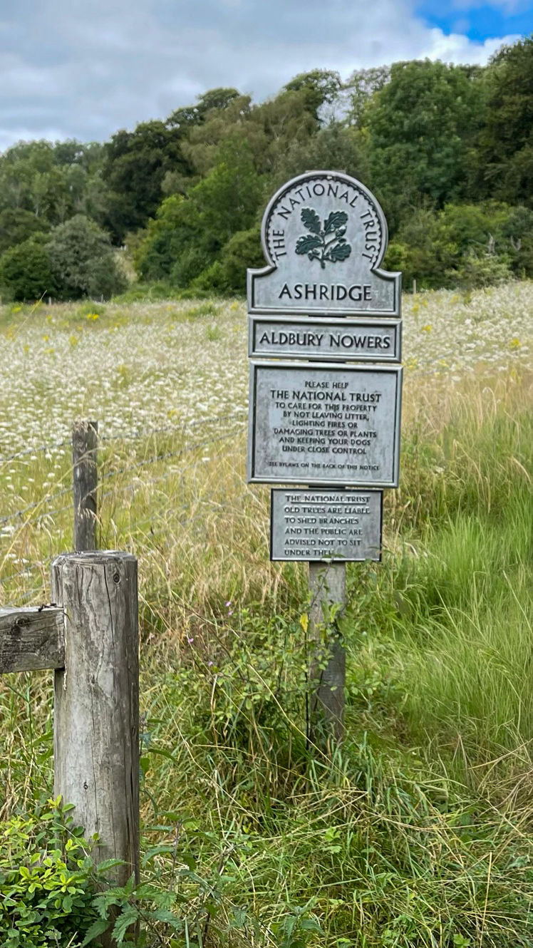
At the end of the High Street we turned right down an alleyway and began a gentle climb along footpaths and narrow lanes into woodland. After about 3 miles of mostly woods we emerged at Hastoe, where after a bit of road walking we entered Tring Park, a 330 acre SSSI comprising a mixture of woodland and grassland, with plenty of footpaths. The wide, main path through the wooded area is at its best in autumn after the leaves have turned.


A carved bench in Tring Park that overlooks the town and beyond provided the perfect excuse to stop to eat our cake that I’d brought with me. It’s a tradition for whenever we do a walk in the Chilterns that I provide coffee and walnut cake.


On exiting Tring Park, my heart rate started to increase because I knew what was coming up very soon. The path descended alongside fields towards the A41 and the railway, with lovely views of the countryside. There is a narrow concrete footbridge across the A41. I don’t know how high above the road it is but it’s very high is all I can say. I read somewhere that it’s about 100 feet high. As I mentioned much earlier when I was having to cross a similar bridge over the A303 at Amesbury, I suffer from an irrational fear of narrow bridges – gephyrophobia! I’ve crossed this particular bridge many times in the past when walking with members of my family and each time it puts the fear of God up me! Knowing that the bridge is coming up sets off my anxiety. You’d have thought by now that it wouldn’t bother me but every time I cross it I feel exactly the same.


Anyway, once across the bridge, my heart rate dropped and I could start to enjoy the walk again. The path carried on downhill before reaching Tring Station. Just beyond the station we turned off to the left and began our final 3 mile climb up towards Ivinghoe Beacon at the top of Beacon Hill. If you’re doing this walk and you have some time to spare, it’s well worth making a short (about 0.7 miles) detour into the village of Aldbury by continuing along the Tring Station road, rather than turning off for the final climb. Aldbury is a picture prefect village complete with village pond. This explains why it’s been used as a filming location for countless films and TV programmes. It goes without saying that Midsommer Murders has used Aldbury in the past; it’s acted as the villages of Midsomer Worthy and Binwell! It also has 2 pubs a village stores. What’s not to like!


So, back to the walk. This was a bit of a slog after walking all day but so worth it for the views all the way up and of course, on reaching the trig point at the top. Ivinghoe Beacon is a late Bronze Age hillfort and the 360° views from the top explain why this was such a good location to choose to defend.


Normally, we would now have to find our way back to Princes Risborough by bus or train in order to pick up my car. However, as mentioned, Nicky lives more or less on the route we’d taken today and her ever obliging husband was able to pick us up and drive us to Princes Risborough where I collected my car. We then drove back to their local pub where we celebrated our achievement and had our tea. What a great day we’d had!
Ivinghoe Beacon marks the end (or start) of The Ridgeway. I’d now completed 201 of the 360 miles of the Great Chalk Way. 2 days later I’d be back here to begin the Icknield Way section with a walk to Toddington.


Comments