Stage 15 - The Ridgeway - Goring-on-Thames to Mongewell - May 31st 2025
- John Tippetts

- May 9
- 5 min read
Updated: Nov 7
Official Stage Statistics
Route distance – 6.02 miles
Total ascent – 158 feet
Total descent – 94 feet
Highest point – 219 feet

Logistics
Drive to Wheel Orchard Car Park in Goring - RG8 9HB - £6 for day - Pay by Phone – location 810584
Walk to Mongewell
Get lift back to Goring & pick up car
Drive home
My Walk
At only 6 miles, this walk was the shortest and undoubtedly the easiest of my 27 Great Chalk Way stages. I probably could have tacked it on to the end of yesterday’s walk from Letcombe which would then have become the 2nd longest. However, I was in no rush to complete The Ridgeway and I do so enjoy this particular section as it takes in my beloved River Thames!
This stage and beyond would mark a change in the nature of the path. I would now be walking in the Chiltern Hills, which by definition means more ups and downs! Relatively speaking, the walks now would become less rural in nature and the wide paths along the top of the ridge, with views for miles would generally be replaced with more varied (but no less attractive) landscapes, narrower paths, more villages, woodland, large fields, even golf courses.
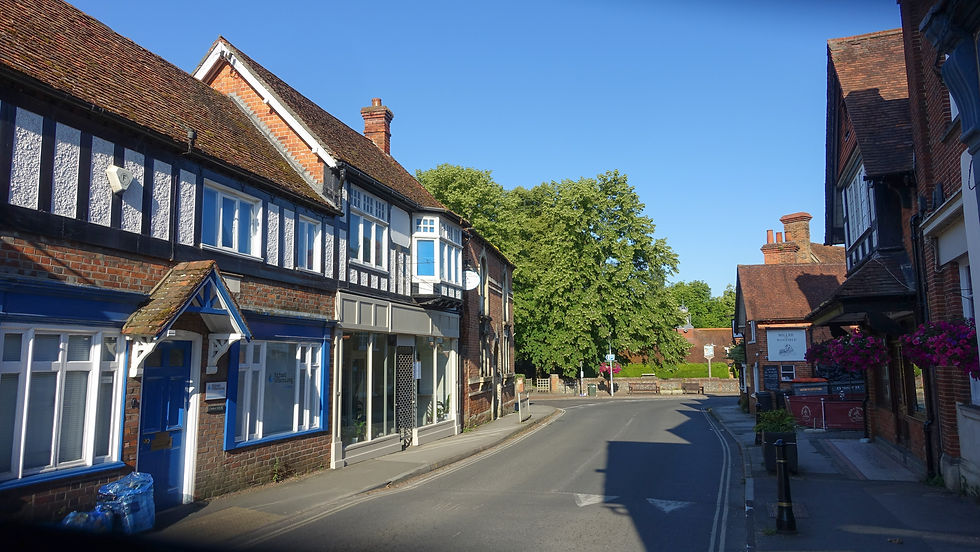
The walk would begin in the streets of Goring-on-Thames - a picture perfect Oxfordshire village. The late George Michael owned a house in the middle of the village – Mill Cottage - and lived here for his last 15 years. He played his part as a resident and his fellow residents treated him as just another neighbour.
As far as the village of South Stoke, the path would be sandwiched between the Thames and the railway with a fair amount of riverside walking. Beyond South Stoke the path would pass under Moulsford Railway Bridge and then continue mostly riverside to North Stoke. Beyond North Stoke the path would continue for a mile to the village of Mongewell where it would turn away from the river for a final ½ mile down to the A4074 Oxford to Reading road. I chose this as the end point because the X40 bus stops here; it’s called ‘Mongewell Turn’.
My day began at the Swindon Town Centre Premier Inn and after breakfast I drove to Goring and parked the car. The Thames Path National Trail between Goring and Wallingford follows alongside the south bank of the river, whereas The Ridgeway National Trail follows alongside the north bank. I have to say I much prefer the route taken by The Ridgeway. Anyway, today’s walk began in Thames Road, a street of large, expensive looking houses with the river to my left and the railway to my right. Beyond this for the next mile or so, the path continued as a mixture of residential roads and bridleways with occasional glimpses of the river.


I soon entered the beautiful village of South Stoke. There were many posters publicising a forthcoming public meeting regarding the recent closure of the village’s pub, The Perch & Pike, after yet another tenant had thrown in the towel, having been unable to make a go of it. As of October 2025, the latest tenant is planning on reopening in early November according to the pub’s Facebook page. I wish them every luck!


The path continued through the village and turned down towards the river. It emerged opposite the Beetle & Wedge pub which all Thames Path walkers must know. This was once a ferry crossing.


I now walked alongside the river towards Moulsford Railway Bridge. Just like its sibling Gatehampton Railway bridge a few miles away on the other side of Goring, this Grade II listed, brick built bridge designed by IK Brunel, is actually a pair of bridges, built in 2 phases 50 years apart. You have to admire the architecture of Moulsford Bridge in particular.


After walking under the bridge, the path continued alongside the river as far as Little Stoke, where it was forced to turn off to the right. For Thames Path walkers it’s opposite the Cholsey slipway and like at South Stoke, there was a ferry crossing here in the distant past.


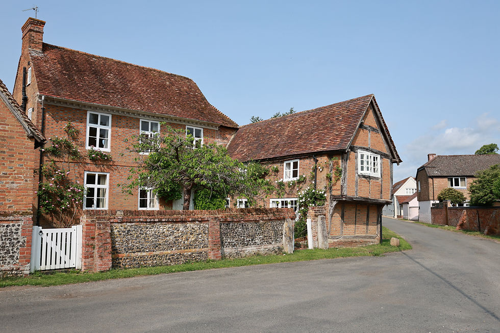
Continuing along the edge of a couple of large fields, I reached the churchyard of St Mary the Virgin in North Stoke. This led to the houses and cottages of the impossibly pretty village! I was treated to a chorus of a group of whistling red kites.


Beyond the village the path headed towards the village Mongewell, intersecting the Springs Golf club in a couple of places. On the left was Mongewell Park, site of a derelict mansion which over the years had various uses. Before being closed in 1997, it was a Jewish boarding school called Carmel College which at the time was the most expensive school in England. The buildings have been derelict since the closure.

At the next T-junction, had I wanted to visit Wallingford I could have turned left to cross Winterbrook Bridge over the Thames. The Ridgeway however turned right for the last ½ mile to the finish. Wendy, who I’d met the day before, had very kindly offered to give me a lift back to my car in Goring. Our paths crossed on this final stretch. In her role as a Friend of the Ridgeway, she took some photos of me at the Mongewell Turn fingerpost and then drove me to my car – what an amazing service!!

Once back at my car I drove home. It might only have been a 6 mile walk but it was so enjoyable. My next stage from Mongewell to Princes Risborough would be a 20 miler but I’d wait a week before resuming my journey.


Comments