 |  |  |  |  |
|---|---|---|---|---|
 |  |  |  |  |
 |  |
Wessex Ridgeway
The Wessex Ridgeway is a magnificent ridge-top long distance multi-use trail crossing Dorset's rural heartland. It runs for 136 miles (219 km) from Lyme Regis in Dorset to Marlborough in Wiltshire, crossing Cranborne Chase AONB and the northern edge of Salisbury Plain.
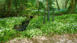
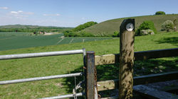
The landscape comprises chalk downlands, greensand ridges and clay vales. The majority of the route follows the top of a ridge but there are some sections which are steep, particularly when dropping down into the chalk valleys and back up again. The surface of the trail varies from hard-surfaced track ways and sunken lanes to grassy or arable fields. There are also a few sections on the road.
The walking route was set up by the late Priscilla Houstoun of the Ramblers’ Association in the 1980s and officially opened in 1994.
About 5 miles to the west of Marlborough, the footpath meets The Ridgeway National Trail at Overton Downs which then continues into Oxfordshire and Buckinghamshire. As previously mentioned however, I decided that I would take the alternative route towards Overton by leaving the Wessex Ridgeway at Win Green and then walking the Cranborne Droves Way to Salisbury followed by the Sarsen Way to Overton Hill.


The four trails I’d completed up to this point – Thames Path, The Ridgeway, Cotswold Way & North Downs Way – all have one thing in common; each one is a designated National Trail and as such is managed and maintained by a dedicated body. As a result, National Trails tend to be better maintained than your average trail; you’ll rarely find a broken stile or kissing gate for example. The signage too is usually superior both in terms of the quantity of the signposts along the trail and the condition of them. The most distinguishing characteristic of a National Trail is the famous acorn logo that you see on most of the signposts along the trail.
So, bearing all the above in mind, the Wessex Ridgeway, whilst being longer and definitely more challenging than its wealthy cousin 'The Ridgeway', is only a ‘named’ trail and the differences in terms of signage in particular would become very apparent from the start of this challenge. The Wessex Ridgeway relies almost exclusively on limited circular waymarkers attached to posts and gates. The waymarker features the image of a green Wyvern, a two-legged dragon associated with the ancient kingdom of Wessex.
Regardless of its status, I had the most amazing time walking along the Wessex Ridgeway through Dorset and into Wiltshire.


The Wessex Ridgeway begins at Lyme Regis in Dorset - 200 miles from where I live. I don’t do camping as I love my creature comforts too much. Premier Inn is my hotel of choice for a number of reasons; you know exactly what you’re going to get in terms of facilities, it’s quick and easy to amend or cancel bookings and you can get a cooked breakfast that will see you through the day from 06:30 in the morning (07:00 at weekends). It's other advantage over Travelodge is that you can leave your luggage either before your check in time or after you've checked out - free of charge. This is a godsend if you don't have your car with you. For my first week I booked 3 nights at the Seaton Premier Inn and 3 nights at the Yeovil Town Centre Premier Inn. Ahead of starting my challenge on the Monday, I drove down to Lyme Regis on Sunday for a bit of a recce, before driving the 8 miles to Seaton.
This part of the country isn’t blessed with the most extensive public transport facilities so I had to carry out detailed planning before setting off. I actually really enjoy this part of any walking challenge which is just as well. Bustimes.org is one of my best friends for determining where the start and end points of each stage should be. It provides you with bus route times and details, maps of bus stops and even real time tracking of individual buses.
Ahead of leaving home I’d printed out the detailed walking instructions for the sections I was going to cover from the LDWA (Long Distance Walking Association) website. Naturally I also have the OS (as in Ordnance Survey) Maps app on my phone. This app is a life-saver and I can’t recommend it highly enough. It costs £30 a year but is worth every penny. It integrates with your PC so that you can plot a route on your computer and view and follow it on your phone. You’d think with the printed instructions and the OS Maps app that it would be impossible to take a wrong turning – think again!!!
The statistics I’m quoting for each stage come from OS Map data. As with every walk I’ve ever done, the reality of distance covered is that it’s always further than it should be; often this is because I decide to take short detours but more likely, take wrong turnings!


