Stage 8 - Sarsen Way - Salisbury to Amesbury - May 8th 2025
- John Tippetts

- May 17
- 5 min read
Updated: Oct 4
Official Stage Statistics
Route distance – 10.19 miles
Total ascent – 775 feet
Total descent - 719 feet
Highest point – 369 feet

Logistics
Drive to Salisbury & park in Central car park SP1 3SL - MIPortal 710180 or scan QR Code
Walk to Amesbury
Catch 8, X4 or X5 bus to Salisbury - 20 mins
Drive to Salisbury South Premier Inn SP1 2FF & stay the night
My Walk
I did this walk out of sequence before I’d finished the Wessex Ridgeway and Cranborne Droves Way stages. This was because ahead of doing these stages I had a spare afternoon in Salisbury and I hate wasting time. It was clear from the stats and fly-through of this stage that it would be pretty easy to complete in less than 4 hours which I did.
Unfortunately, it was a bit of a cloudy day on May 8th so my photos of the walk weren’t as good as I’d wish them to be. As it's highly unlikely I'll ever repeat the Great Chalk Way and I want my blog to reflect the path at its best, I repeated this stage in its entirety later in August on what was an absolutely gorgeous day. Most of my photos are therefore from August which explains the brown grass and fields! This wouldn't be the only stage I'd repeat before reaching Holme-next-the-Sea; I also repeated a couple of stages along The Ridgeway for the same reason! In all I walked an extra 40 miles. I know I'm crazy but that's just the way I am!
Starting from the Cathedral, the path would take me northbound alongside the River Avon a short distance before turning off and heading uphill to Old Sarum. Turning left at Old Sarum I’d walk almost straight ahead for the next 3 miles to the pretty village of Upper Woodford, followed by the equally pretty village of Great Durnford. Another 2½ miles through some woodland and across fields and I’d reach the end of the walk in Amesbury.
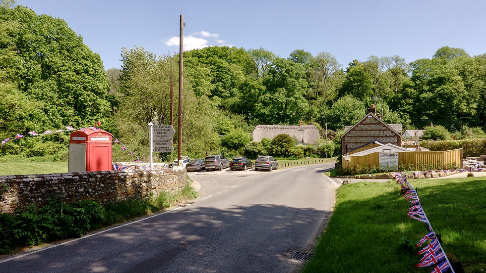
Setting off from Salisbury Cathedral I couldn’t see any fingerposts or waymarkers for either the Sarsen Way or its close friend the Pewsey Avon Trail. I knew however which way to go through the city centre and towards Salisbury River Park.


Very soon I reached Salisbury River Park. Lifted from local.gov.uk “The Salisbury River Park Project is an ongoing collaborative project between Wiltshire Council and the Environment Agency, with support from both the Swindon and Wiltshire Local Enterprise Partnership (SWLEP) and Salisbury City Council to deliver essential flood alleviation and major environmental improvements through the central riverside spine of the historic city of Salisbury.” Whilst the work hasn’t finished, I could see how attractive this part of Salisbury will eventually look. For now, there are loads of metal fences keeping you away from the building works. I took the option to walk along the official path between this fencing. I didn’t know at the time that there was also another option to walk along an attractive boardwalk through Avon Valley Nature Reserve alongside the river which would bring me out on the official path – not to worry.


Eventually the path crossed the Avon & emerged onto Stratford Road in Salisbury where I turned right and crossed to the other side of the road. At a gap between 2 houses was a path leading up to Old Sarum.


Old Sarum is a fascinating place to visit. It began life as a large Iron Age fort dug around 400 BC. It was the site of the earliest settlement of Salisbury, about 2 miles north of modern Salisbury. Centuries later the Normans constructed a motte and bailey castle, a stone curtain wall and a great cathedral within the fort. A royal palace was built within Old Sarum Castle for King Henry I. Constant disputes between the monarchs of the day and church powers eventually led to the construction of a new cathedral in ‘New Salisbury’. Construction began in 1220 and was completed in 1258 using some of the stone from the original cathedral that was slowly dismantled. The foundations of the original cathedral can still be seen however.
Today English Heritage manages Old Sarum and entrance costs £6.50. Note however, that you’re paying to view the remains of the Norman castle as everything else including the old cathedral’s foundations and walking along the ramparts of the original fort is free. I really enjoyed spending some time there.


After Old Sarum the trail continued along a dead straight chalk path that seemed to go on forever. I could imagine traders from thousands of years ago driving their ox carts along this path! Eventually this path came to an end and gave way to a steep descent through the woods of Little Durnford Hill into the riverside village of Netton.


A short walk along the road and I came to Woodford Bridge and the village of Upper Woodford. Wow! A lovely view of thatched roof properties, the River Avon and a pub!


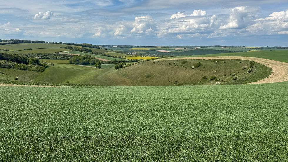
Beyond Upper Woodford the path continued alongside the River Avon and reached yet another pretty village - Great Durnford. A climb up the road out of the village was followed by a moderately steep climb up through Beech Wood before the path opened up onto fields with far reaching views.


Soon the houses of Amesbury appeared and the path descended gently towards the town. What a thoroughly enjoyable walk this had been!


Amesbury is really well blessed with buses back to Salisbury, even on Sundays and Bank Holidays. Being south of the A303 and the Stonehenge pinch point means that the buses can get back to Salisbury in around 20 minutes.

Comments