Stage 12 - The Ridgeway - Ogbourne St George to Ashbury - May 19th 2025
- John Tippetts

- May 12
- 6 min read
Updated: Oct 23
Official Stage Statistics
Route distance – 9.97 miles
Total ascent – 801 feet
Total descent – 610 feet
Highest point – 905 feet

Logistics
Walk to Swindon Bus Station
Catch bus X5 at 08:25 to Ogbourne St George Southend stop arriving at 08:57
Walk to Ashbury Rose & Crown
Catch 17:17 bus 47 to Swindon Bus Station arriving 17:45
OR
If early call for a taxi - Wayland Private Hire - 0800 7999682 to Shrivenham
Catch S6 bus to Swindon Bus Station
OR (if you have a car)
Drive to The Ridgeway car park on Ashbury Hill and park car
Catch bus 47 from the car park to Great Western Hospital in Swindon at 08:10
Catch bus X5 from Great Western Hospital in Swindon to Ogbourne St George Southend stop at 08:52
Walk to Ashbury, pick up car and drive to Swindon Premier Inn
NB – Since August 2025 Swindon Bus Station has thankfully closed as buses now leave/arrive from the new public transport hub in Fleming Way
My Walk
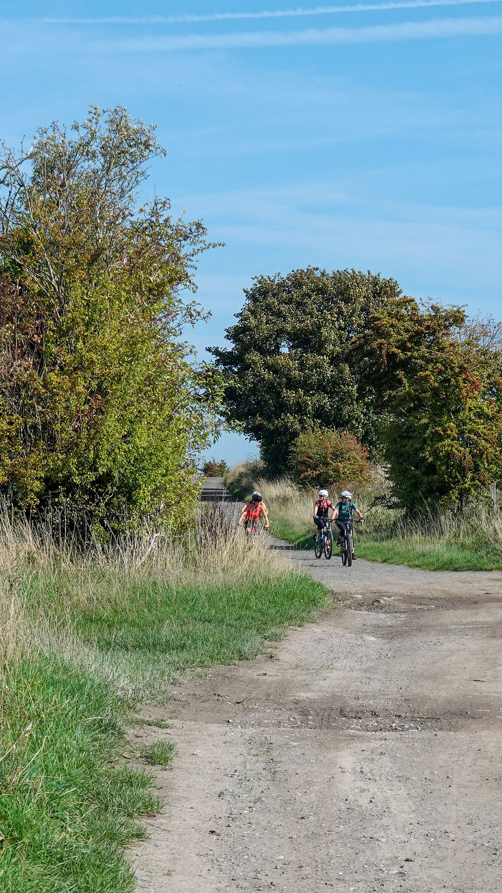
Like the previous stage, Ogbourne to Ashbury is really just a half day walk but provides public transport at both ends for solo walkers like me which is the main thing. The first 3½ miles of today’s walk would involve a steady climb from the busy Swindon to Marlborough main road up onto the ridge. Much of this would be walking along a path with trees and high hedges on both sides so limiting the views. At this point the path would open up to give some great views of the countryside. After reaching the highest point of the walk at Liddington Hill, the site of another Iron Age hillfort, I’d make a descent from the ridge, down to the M4 which I’d cross. The final 3½ miles would involve a gentle climb back up onto the ridge followed by a relatively flat, almost dead straight walk along it to the car park at the top of Ashbury Hill.
This was another stage that I walked twice – firstly in May and then in September. In May it was pretty overcast for the whole walk so I resolved to repeat it on a sunnier day and my photos are mostly from September.
In May my day began at the Swindon Town Centre Premier Inn with my 4th consecutive full English breakfast. By now I’d got to know the staff quite well! The X5 bus from the bus station dropped me at the ‘Southend’ stop at Ogbourne St George on the busy A346. A short walk back along the road and there was a familiar black Ridgeway fingerpost pointing up to a path towards Liddington Castle, just over 5 miles away.

The path up to the top of the ridge wasn’t desperately interesting as it was relatively narrow and had trees and high hedges on both sides. There were occasional breaks however which gave good views of the landscape.
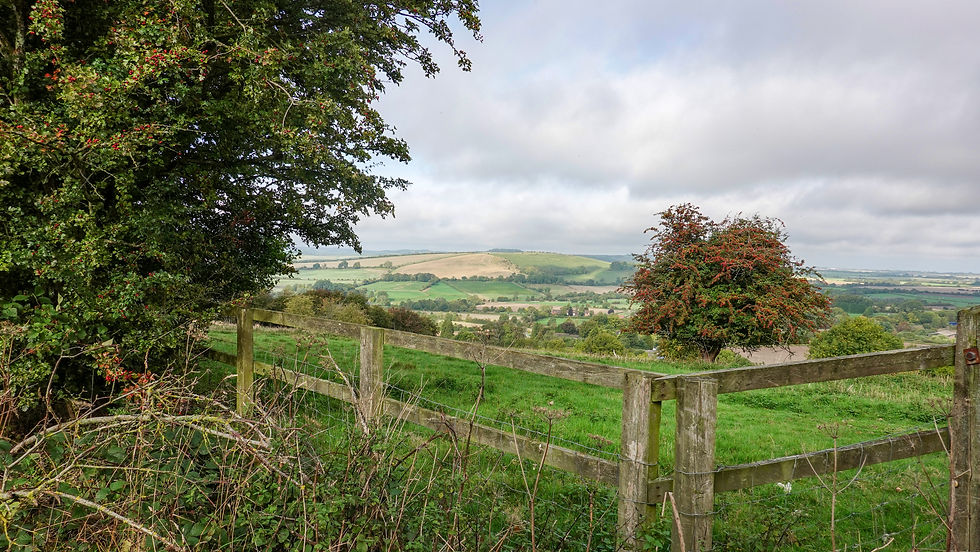
After almost 3 miles of gentle climbing, the path opened up briefly at the top of Whitefield Hill where there is a tall mobile phone mast. It didn’t take long however before I was back to trees and hedges on both sides of the path, with openings here and there. It was about now that I noticed the sound of almost constant shooting going on to my left in the distance. This went on for quite a while and I assume it must be coming from a gun club.


Eventually the path opened up once again to give great views as it dipped up and down before climbing up towards Liddington Castle.


Liddington Castle is another Iron Age hillfort and sits at the top of Liddington Hill, 902 feet above sea level. It's the highest spot in the Borough of Swindon! There is a trigpoint within the fort and next to it is a toposcope installed by the local council to commemorate the year 2000. It’s quite a bit smaller than Barbury Castle and is one of the earliest hillforts, constructed about 700 BC. To reach it there is a very short diversion off The Ridgeway. I took a look when I did this walk in May but in September I let my drone do the hard work!


Continuing past the hillfort I couldn’t help but notice what looked like a pillbox under a small clump of trees. Subsequent googling revealed that during the Second World War, the hilltop surrounding Liddington Castle was used as a Starfish site - a large-scale bombing decoy designed to appear as a burning town or city. The idea of this one was to divert German night bombers away from Swindon so that they would drop their bombs over the countryside instead. Starfish sites consisted of elaborate light arrays and fires, controlled from a nearby bunker and laid out to simulate a fire-bombed town. So, what I thought was a pillbox was actually a command bunker. The things you learn!

The path now descended from the ridge to a fairly busy main road, before turning down an almost equally busy road that took me across a bridge over the M4 to the village of Foxhill. This one mile second road was less than satisfactory as the verges were almost non-existent in places and it was easier to walk along the road; I expect that’s why there’s such a large warning sign to motorists advising them that the road is part of The Ridgeway National Trail.


In Foxhill, the path left the road and immediately started climbing up to Charlbury Hill. The top of the hill could be seen a short distance from the path. From the path it looked like it could be another hillfort but in fact it’s been found to be 100% completely natural with no recorded archaeological discoveries.


About ½ mile further on and to my left, I reached the entrance to a striking, steep dry valley known as a coombe. This had been sculpted by the action of water long ago when this area still supported surface streams. Along the steep sides of the coombe you can see examples of vertical strip lynchets. Lynchets are a feature of ancient field systems in the British Isles and are found close to Iron Age forts. It is most likely that lynchets were dug to maximise the use of land for agriculture, although they may have had other, ceremonial uses. The coombe descends more than 100 feet to the village of Bishopstone.

The final couple of miles of this stage were uneventful, the path being almost flat and straight. It was lovely though walking along it in the sunshine with large rolling fields either side.


There is a car park at the top of Ashbury Hill where it crosses The Ridgeway. Handily, there are also bus stops here for the Lambourn to Swindon bus 47. When I did the walk in May, before reaching the car park, I turned off to my left and followed a footpath into Ashbury. At the planning stage I’d intended catching the bus from there back to Swindon. However, I finished the walk way too early, so instead of hanging about for 4 hours, I called a taxi firm in nearby Shrivenham in the hope that I could be picked up a little sooner than this – Wayland Private Hire . John the proprietor arrived quite quickly and brought me back to Shrivenham. He charged me a very reasonable £10. I then caught the S6 bus to Swindon Bus station and walked ‘home’ to the Premier Inn for my final night.
In September I had a better plan not involving taxis. I first drove to the car park at Ashbury Hill and got 2 buses to Ogbourne St George. Despite this sounding rather convoluted, I arrived at Ogbourne by 09:30. I then did the walk to where my car was parked, finishing just before 14:00.


Comments